


Cyclone Vaianu

A timeline of the lifecycle associated with Cyclone Vaianu and meteorological observations on the Upper North Island, NZ.
04 April – Deep convection develops around low level circulation centre NE of Vanuatu and tropical low was named 91P by the JTWC

05 April - JTWC names tropical cyclone 31P and soon after Fiji Met service names tropical cyclone Vaianu

07 April - Severe Tropical Cyclone was now a category 3 system to the west of Fiji with sustained winds of 95 knots and tracking SE at 7nots.

09 April Cyclone Vaianu was 400 km northwest of the Kermadec Islands and was transitioning into a subtropical cyclone. Air pressure was at 969 hPa - sustained winds 55 knots.
10 April - The first visual signs across the upper North Island of the approaching subtropical cyclone with cirrus clouds creating Halos and vivid sunsets,


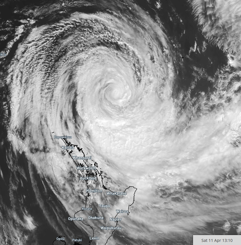
11 April - Vaianu picked up speed overnight travelling south-west along the high-pressure ridge towards the upper North Island. Severe gale southeasterlies and heavy rainbands spiraling on its outer were starting to impact the upper North Island.
By 9:00pm
Pressure: 975 hPa Sustained winds: 60 knots
Winds gusts: 80 knots
Tracking: SW 9 knots
Location: 32.9°S, 175.7°E, 310km NE of Whangarei
Notable weather station observations to 9:30pm
Wind gust 148 km/h (80 knots) - Kaeo
Sustained winds 100 km/h (53 knots) - Mokohinau Islands
Lowest pressure 996 hPa - Mokohinau Islands
12 April
Vaianu still remained a hybrid subtropical system, generating heavy rainbands wrapping into the upper North Island. Landfall was starting to look likely on Western Bay of Plenty in the early afternoon.

By 10am
Pressure: 978 hPa
Sustained winds: 55 knots
Winds gusts: 80 knots
Tracking: SSE 17 knots
Location: 35.8°S, 176.4°E, 70km ENE of Great Barrier Island
Severe gales were starting to pound the eastern side of the Coromandel Peninsula.
Landfall
Vaianu has crossed the coast over the eastern outskirts of Tauranga at 1:55pm. Official barometric air pressure at Tauranga airport bottomed at 978 hPa. A private weather station at Pukehina beach in the storms centre bottomed at 974.1 hPa.

Notable observation for the upper North Island.
Rainfall
258mm - Coromandel Peninsula (Pinnacles)
135mm - Northland (Whangarei)
109mm - Auckland (Makarau)
Wind gusts
148 km/h Northland (Kaeo)
132 km/h Coromandel Peninsula (Channel Island)
Lowest pressure on landfall
974.1 hPa Tauranga Private weather station
978 hPa Tauranga airport


Comments